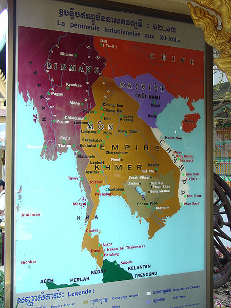
Map of the Khmer Empire
Royal Palace Grounds, Phnom Penh
The map shows the Khmer Empire at its greatest extent, from the 12th-13th centuries. To the left is Burma, with Arakan at its border (far left). To the right are North Vietnam (Dai Viet) and South Vietnam (Champa); China at the top (appropriately colored red); and a slice of Malaysia (green) at the very bottom of the map. Laos is not shown on this map, because the country did not exist at that time.
